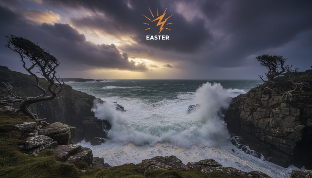
UK Weather Warning Strong Winds – Amber Alert Hits Scotland Over Easter
Storm Dave is set to bring disruptive conditions to large parts of the UK, with the Met Office issuing an amber wind warning for central, eastern and northern Scotland alongside yellow alerts for Northern Ireland and northwest England. The warning, active from later Saturday into Easter Sunday morning, forecasts gusts reaching 60-70 mph in exposed locations, with a slight chance of 80-90 mph in the most vulnerable spots.
The alert highlights risks of travel cancellations, power outages and structural damage from flying debris. Residents in affected regions should brace for potential road closures, bridge restrictions and coastal hazards as the storm tracks across the country during the Easter weekend.
Which Areas of the UK Are Affected by the Strong Winds Warning?
Amber Wind Warning Active
Scotland, Northern Ireland, North West England
Central and Eastern Scotland
All Warned Coastlines
- Amber warning covers 22 council areas in Scotland including Glasgow, Aberdeen and Dundee
- Yellow warnings extend to all six counties of Northern Ireland and seven local authorities in North West England
- Very exposed locations could see gusts up to 90 mph
- Transport networks expect significant disruption across rail and ferry services
- Power cuts may affect mobile phone coverage in remote areas
- Flying debris poses risk to life and property in amber zones
- Coastal communities face dangerous wave conditions
| Warning Level | Regions | Wind Speeds | Start Time | End Time | Issued By |
|---|---|---|---|---|---|
| Amber | Central/East/North Scotland | 50-60 mph widely, 60-70 mph exposed | Later Saturday | Sunday morning | Met Office |
| Yellow | Northern Ireland | 50-60 mph gusts | Later Saturday | Sunday morning | Met Office |
| Yellow | North West England | 50-60 mph gusts | Later Saturday | Sunday morning | Met Office |
The amber zone encompasses Central Scotland including Glasgow and Stirling, Tayside and Fife covering Dundee and Perth, Grampian with Aberdeen, and extensive portions of Strathclyde. Detailed regional maps show the precise boundaries.
When Does the UK Strong Winds Warning Start and End?
The warning period spans from later Saturday through to Easter Sunday morning, though the Met Office has not specified an exact hour for commencement beyond “later Saturday”. Peak impacts are expected overnight Saturday into the early hours of Sunday.
Regional Timing Variations
While the broad timeframe applies across all affected regions, northern Scotland may experience the strongest gusts earlier in the period, with conditions gradually easing southward through Sunday morning. National Rail advises that Sunday services may face residual delays even after winds abate.
Why the Timing Matters
Overnight storms complicate emergency response capabilities and increase risks for early Sunday travelers. The Easter weekend timing coincides with increased leisure travel, amplifying potential disruption to holiday plans.
Amber warnings indicate potential risk to life from flying debris and falling trees. Avoid unnecessary travel between midnight Saturday and 6am Sunday when emergency services face greatest strain.
How Strong Are the Winds Expected to Be?
Wind speeds will vary significantly based on exposure and topography. The Met Office indicates widespread gusts of 50-60 mph across warned areas, increasing to 60-70 mph in exposed locations. A slight chance exists of 80-90 mph gusts in very exposed spots, though this remains at the upper threshold of forecast models.
Understanding the Warning Levels
Amber warnings indicate an increased likelihood of impacts from severe weather, representing a step up from yellow alerts. The threshold typically involves wind gusts of 70-80 mph in coastal areas or 60-70 mph inland, though local topography influences these boundaries.
Historical context suggests Scotland previously experienced 100 mph gusts during Storm Amy, but current projections for Storm Dave remain below those extremes.
What Impacts Are Forecasted from the Strong Winds?
The Met Office has identified multiple risk vectors extending beyond simple wind damage. Road, rail, air and ferry services face probable delays and cancellations, with some roads and bridges likely to close preemptively.
Infrastructure and Power Risks
Power cuts remain probable across northern regions, potentially affecting mobile telephone coverage. Previous storms caused significant disruption, with Storm Floris earlier this year leaving 10,000 homes without power in Ireland and prompting flight diversions.
Charge mobile devices before Saturday evening. Keep torches, batteries and warm blankets accessible. Avoid using candles due to fire risks from drafts.
Coastal and Structural Hazards
Large waves will create dangerous conditions along exposed coastlines. Structural integrity concerns include roof tiles becoming dislodged and trees uprooted in saturated ground. Official guidance recommends securing loose garden items and parking vehicles away from trees.
Wave overtopping and beach material thrown onto promenades present greatest risk three hours either side of high tide during peak winds.
Timeline of the Storm Dave Warning Period
- : Met Office monitoring intensifies as low pressure system approaches from the Atlantic
- : Amber and yellow warnings activate across Scotland, Northern Ireland and northwest England
- : Peak wind gusts reach 60-70 mph in exposed Scottish locations, similar to Storm Amy conditions
- : Strongest winds shift eastward, affecting North Sea coasts and Northern Ireland
- : Winds gradually ease from the west as system moves into the North Sea
- : Warnings expire, though residual delays continue on transport networks
What Do We Know for Certain About This Warning?
| Established Facts | Remaining Uncertainties |
|---|---|
| Warning active later Saturday to Sunday morning | Exact hour of warning commencement |
| Amber level for central/eastern/northern Scotland | Whether 80-90 mph gusts will materialise |
| Yellow level for Northern Ireland and northwest England | Specific bridges or roads scheduled for closure |
| Widespread 50-60 mph gusts certain | Duration of individual power outages |
| Travel disruption expected across all modes | Precise storm track adjustments |
Why Has the UK Issued a Strong Winds Warning Now?
The Met Office issues warnings when weather patterns threaten to breach thresholds endangering life or disrupting essential services. Storm Dave represents a significant low-pressure system tracking across the UK during a holiday weekend when population movement increases. British Born Children of Migrants – Citizenship Rules Explained provides context on population demographics in affected coastal regions. For additional context on the impact of such events, you can refer to Benfica Auckland City 6-0.
Comparisons with recent storms suggest forecasting models indicate sufficient confidence in damaging wind speeds to warrant amber status. The Easter timing elevates the risk profile due to increased leisure traffic and outdoor activities.
Climate patterns show increasing frequency of named storms during spring months, though individual events remain distinct meteorological phenomena requiring separate assessment.
What Official Sources Are Monitoring the Storm?
“Very strong winds… which may cause some damage and travel disruption”
— Met Office Storm Dave Warning
“Amber warnings indicate a potential risk to life and property. Secure loose items and avoid travel if possible.”
— BBC Weather Analysis
What Is the Forecast After the Wind Warning Ends?
Conditions should improve markedly from Sunday morning as winds ease across all regions, though residual travel delays may persist through the afternoon. Heavy rain from prior weather systems may continue in some areas. Those facing employment disruption due to storm damage should consult How Much is Universal Credit – Rates and Allowances 2025 for benefit information. Monitor the Met Office warnings page for subsequent systems developing in the coming week.
Frequently Asked Questions
Why has the UK issued a strong winds warning?
The Met Office issued the warning due to forecast gusts of 60-70 mph threatening travel disruption, power cuts and structural damage during the high-traffic Easter weekend.
What safety advice applies during an amber wind warning?
Secure outdoor items, plan journeys carefully, avoid exposed coastal areas and prepare for potential power cuts. Consider whether travel is essential.
Is the strong winds warning still in effect?
Yes, warnings remain active from later Saturday through Easter Sunday morning for Scotland, Northern Ireland and northwest England.
Which travel services face the highest disruption risk?
Rail, ferry and road bridges face greatest disruption, with flight diversions possible at exposed airports including Inverness and Aberdeen.
How do amber and yellow warnings differ?
Amber indicates likely disruption and potential risk to life or property requiring action, while yellow advises awareness of possible impacts.
What wind speeds define each warning level?
Yellow covers 50-60 mph gusts with potential impacts. Amber triggers at 60-70 mph inland or 70-80 mph coastal, with expected disruption.
More related posts
 What Language Do They Speak in Belgium – Facts by Region
 What Language Do They Speak in Belgium – Dutch French German
 Inheritance Tax When Second Parent Dies – UK Rules and Thresholds
 What Is Primary Research – Definition, Methods and Examples
 Can You Take Aerosols on a Plane – UK Rules Guide
 Paris Fashion Week 2025 – Dates, Schedule and Guide
 How to Declutter Your Home – Complete Step-by-Step Guide
 Man U vs Newcastle – Newcastle’s 2-0 Victory at Old Trafford